This project - Yon, or Springtide, or The World, or whatever I decide to call it - is many years in the making.
To start, see an overview of the world, or pick from some of my favorite entries.
This wiki-thing is and will probably always be a work in progress, so if you stumble across a broken link, like this one, check back in a little while.
Where did this come from?
It began with maps, and names on maps, and over time I began to figure out what those names meant.
This world, as it now stands, is built on a few foundations. Primarily, it comes from my love of the outdoors. Almost everywhere on the map is a direct result of an experience I've had, in the mountains, or on some wild coast, or in a small town with a house I like. Just like photography is collection, worldbuilding is collection, and my map is a collection of the things I have seen and heard and loved.
As such, most of this world is tone. Yes, there is history, and the names of people, and probably someone in Daybreak has died of a disease; these are all very real things.
But, in large part, these real things, these 'facts,' are like the mortar between flagstones. The real heft of this world is in feeling.
The feeling I get when I look out at the sea. The feeling I get when I climb a big rock and feel very, very small. The feeling I get when I find myself, whirling, in an utterly new place.
Yon - or, at least, the Cauldron - is not a land of magic. It is a land of glimpses of magic. Of wonder and wondering. Of the feeling you get when you look to the clouds and imagine the angels that live there. Of magic maybe not here, but somewhere.
I explored these feelings, in a way, in my photobook Lingermyth, and in my undergrad dissertation, On Yearning.
The Map
I started making maps when I was 10, or 12, or something like that. I'd make worlds with friends, or doodle alone, little mountains and forests and squiggly coasts.
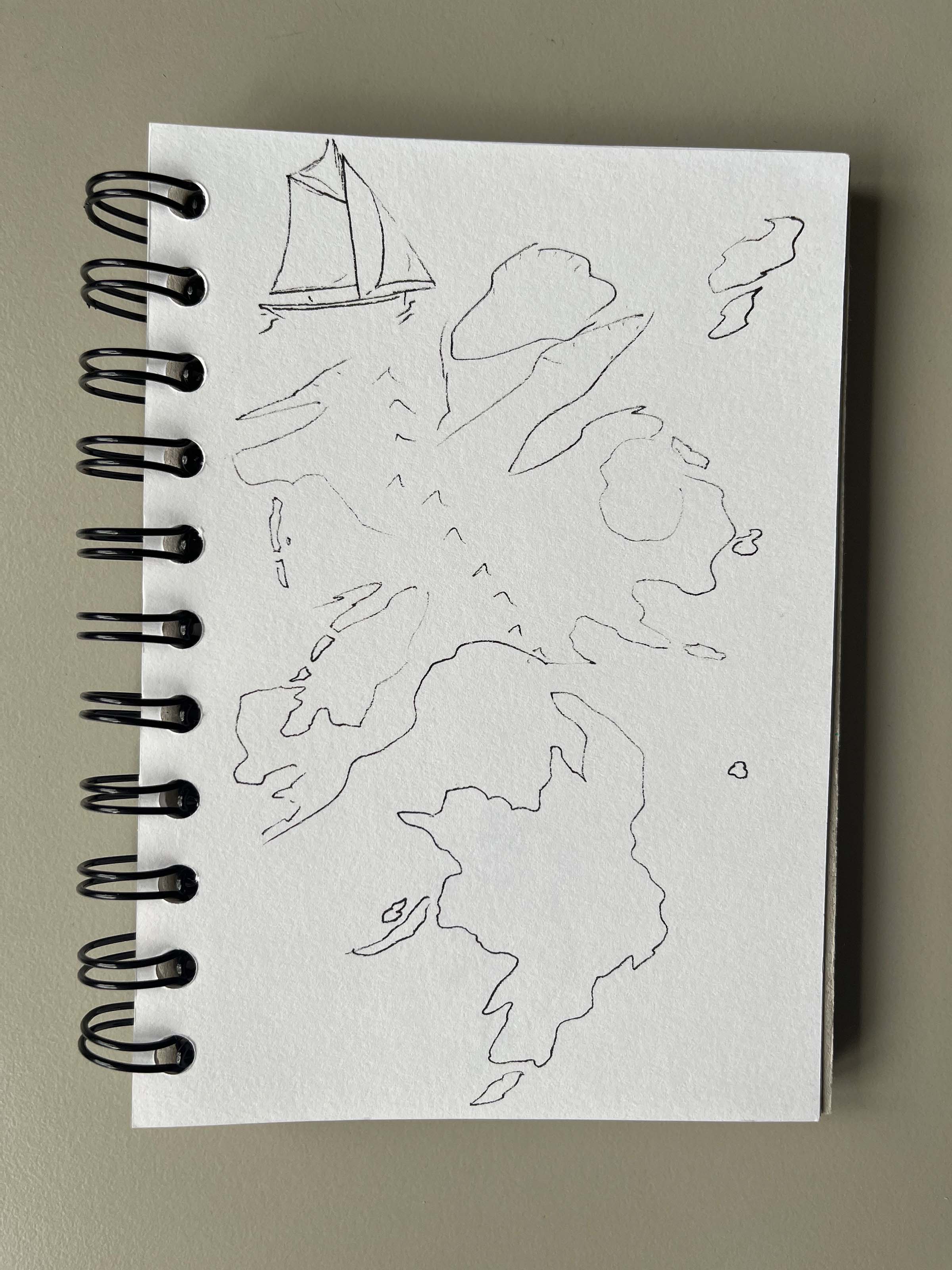
 Earliest recorded history.
I drew the same few shapes again and again, version after version. I wasn't really sure what I was after, but I knew I liked those elemental swoops and forms.
 Familiar shapes.
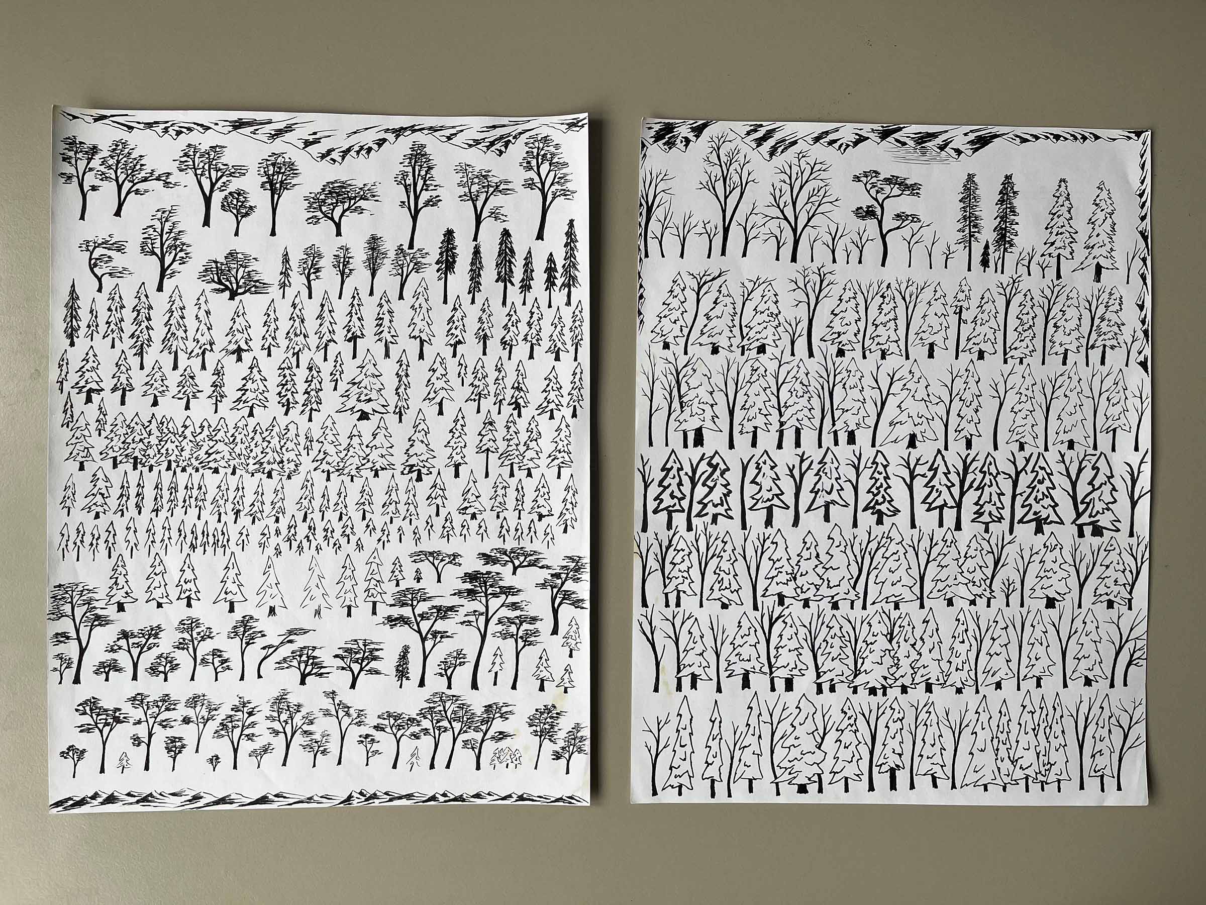 Trees and mountains and more trees.
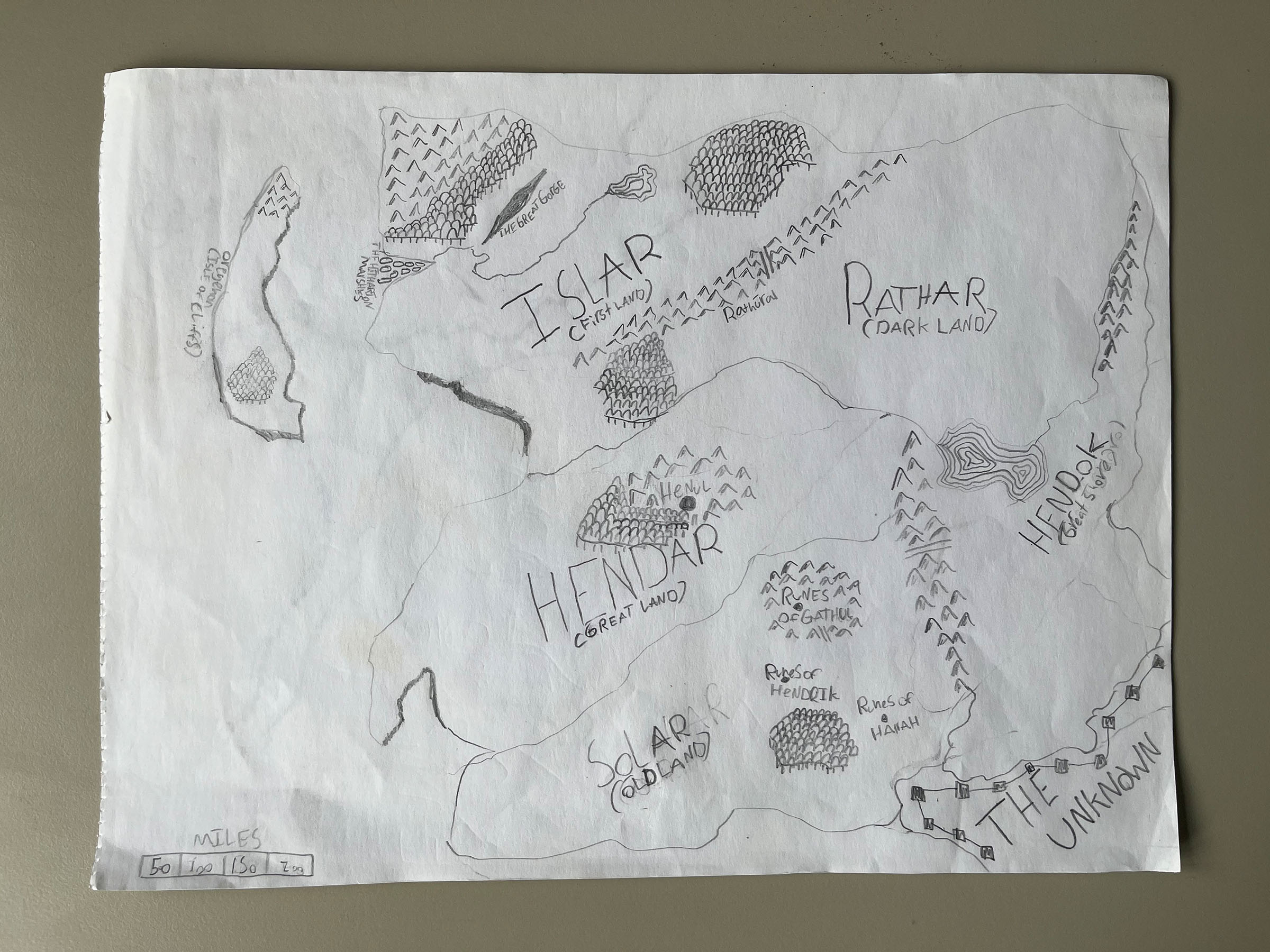
In bigger maps, even though the coastlines would change and features would come and go, I always used the same names. I felt like I was uncovering a place that already existed.
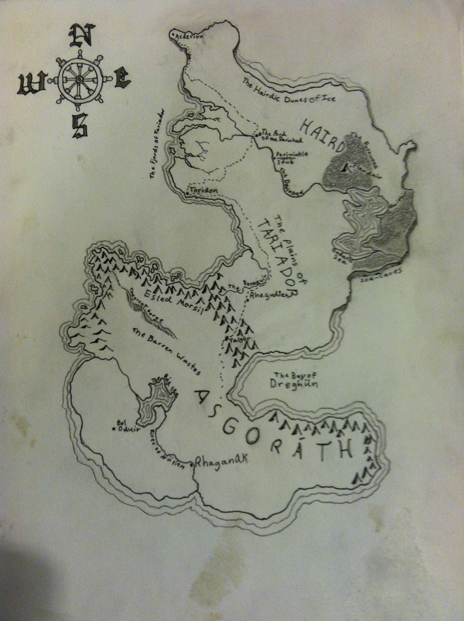 You can tell this is old by how gross the paper looks.
Going Electric
Around 2016, I started making maps with a drawing tablet in Photoshop.


I started stylized, but this tutorial sent me on a multi-year tangent of realistic maps. I loved drawing these mountains, but the file was way too big and the text was way too small for me to fill and maintain.


Present Day
Eventually, I abandoned that for watercolor brushes. In the past few years, I've tried to embrace the feeling of the world. It's brighter and more abstract and colorful than before, which I think fits the place.
This was my first attempt at a more impressionistic map:
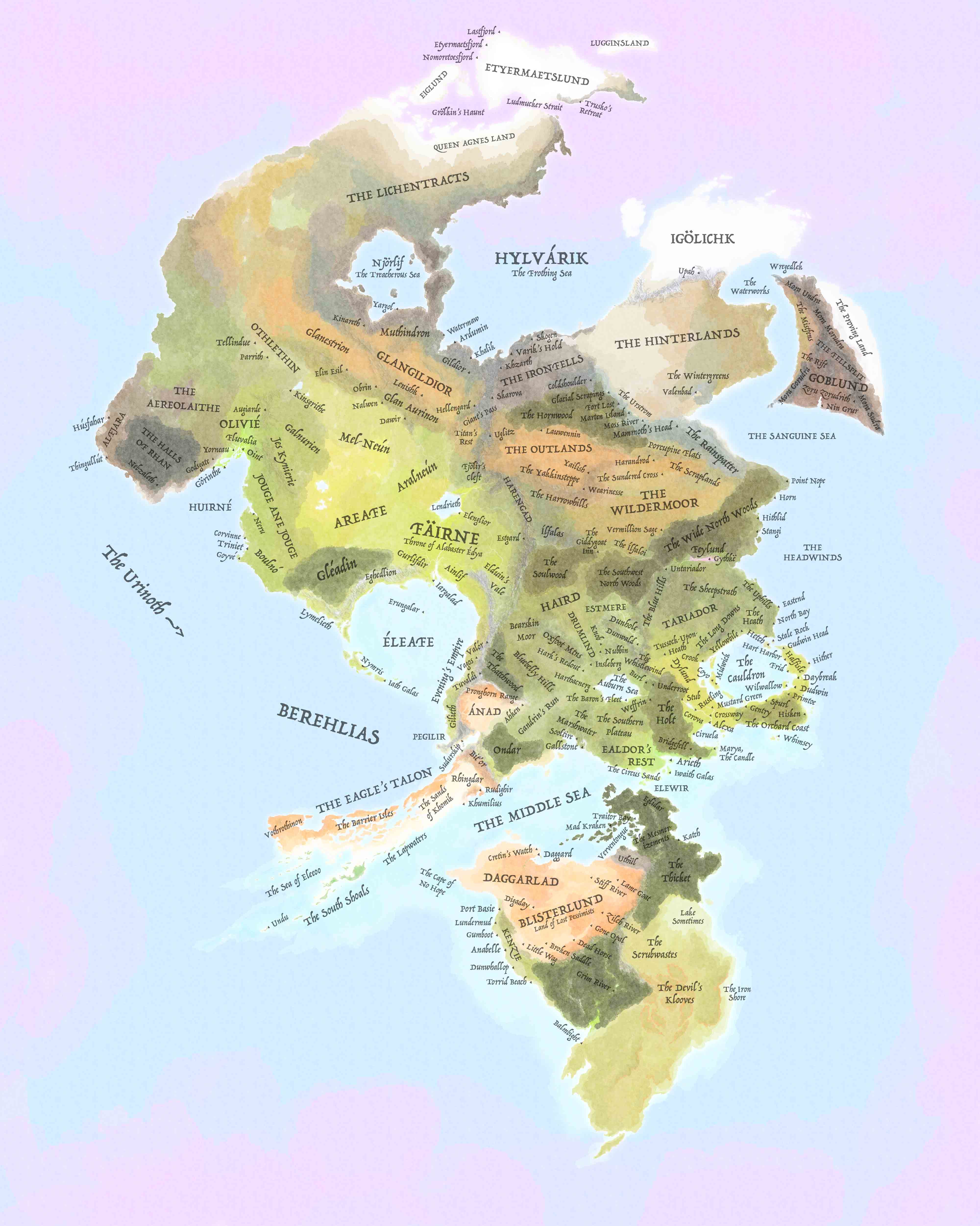 2019-2022
In summer 2022, I started over, using a smaller canvas and more intense colors. I broke up the land, too, giving everything space. Where before I drew great tracts of land with no idea what was there, here I wanted every coast to have a reason for being. This map is tighter, more intenional. I'm not sure when I'll start the next iteration (it'll come, I'm sure) but for now I'm happy with where it is.
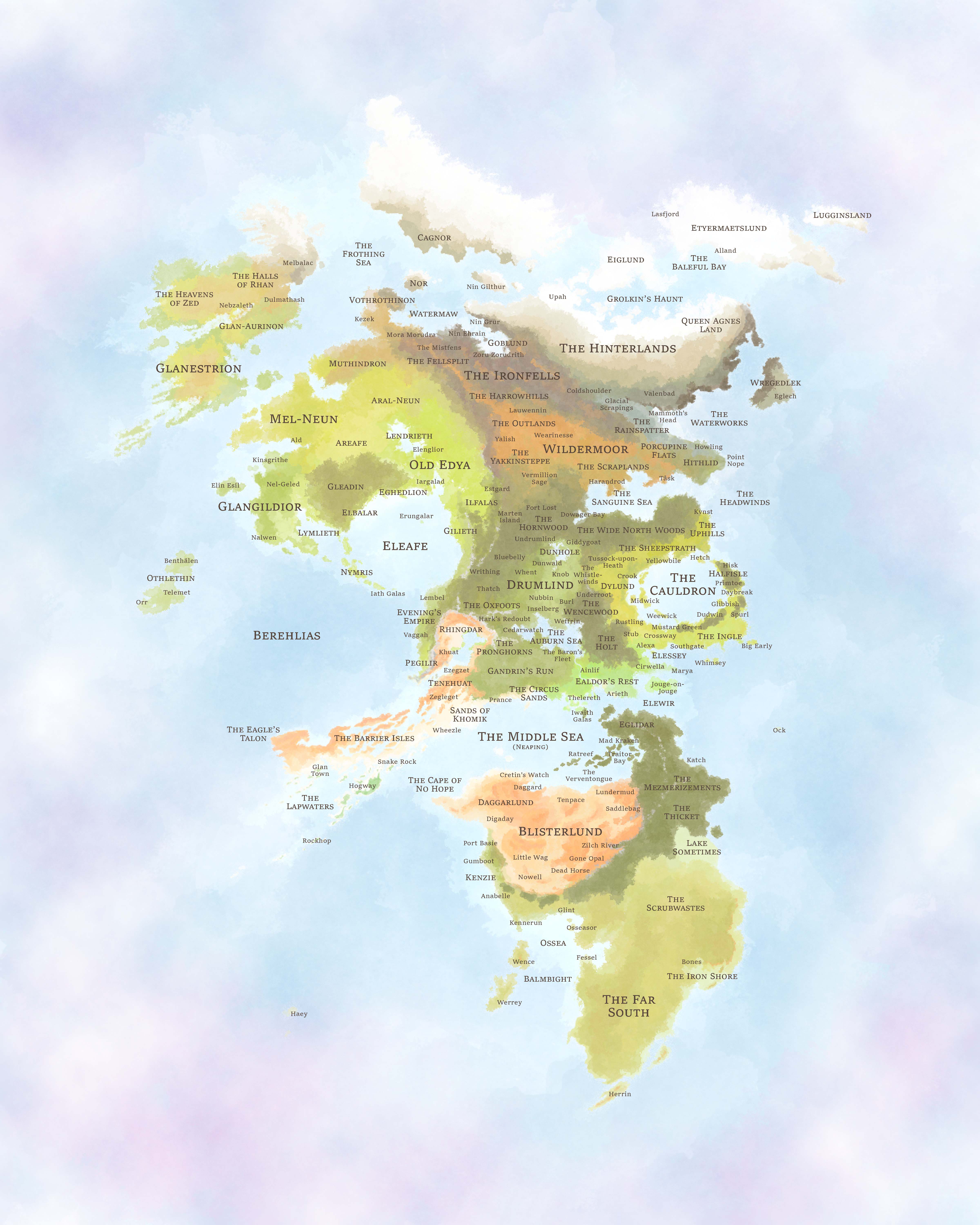 2022-Present